BC’s emergency flood preparedness, or lack of, is being put to the test—again.
Interior communities like Princeton and Merritt have barely even thought about rebuilding after the November 12 rains. Now, more atmospheric rivers are flowing toward the province.
Vancouver Island could be hit next.
Flood risk expert Jason Thistlewaite from the University of Waterloo analyzed floodplain maps across Canada. He and his team published their findings in a 2019 paper. They found that BC’s maps are grossly inadequate and outdated. In other words, our maps suck.
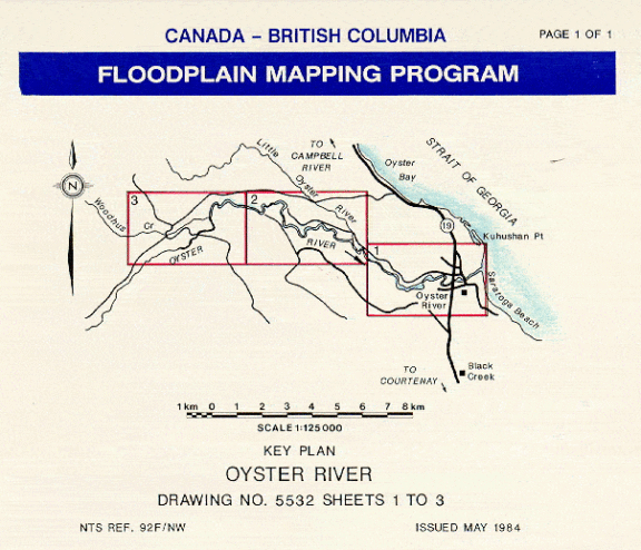
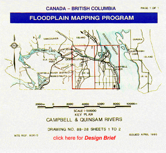
The BC government identifies 17 regions on Vancouver Island that the feds designated as flood risk areas back in the 70s. These maps were all created between 1979-97. They have not been updated since.
The maps don’t include new knowledge about climate change-related risks. They’re also missing the massive developments and roads that have happened since, you know, Y2K.
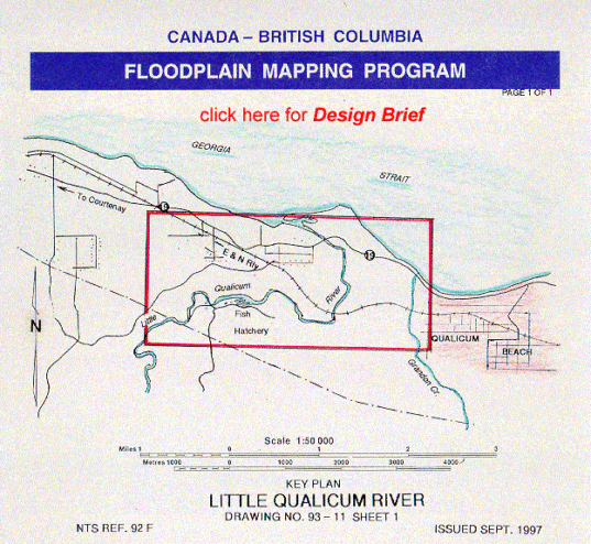
BC Government Floodplain map 
BC Government Floodplain map 
BC Government Floodplain map
Take a look at the three maps above. Notice anything missing?
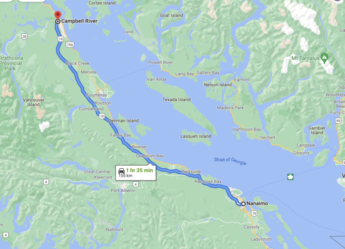
Credit: Google Maps
That’s right, the four-lane Highway 19 between Nanaimo and Campbell River is missing. They didn’t finish building that until 2002.
Do you think the 155 km long concrete highway that crosses hundreds of streams might affect how flood water flows?
How can towns on Vancouver Island do proper flood planning when its largest man-made structure that impacts untold numbers of streams isn’t even on the map?
They can’t!
Not only are the maps outdated, they’re also confusing and difficult for the public to understand.
“The [maps] are very old. Property has changed. There [are] developments in areas that didn’t exist before,” Thistlewaite said in a Nov. 21 Capital Daily report.
“There’s sort of a thick line that represents the floodplain. It’s very difficult to identify any other geographical markers that would give you a sense of whether or not you were at high risk of flooding.”
Between 2003 and 2012, Canada spent more than $20 billion rebuilding damaged homes and infrastructure after extreme rainfall events. Climate experts say we can expect more, not less, of these flood-causing weather events.
Building climate-resilient communities is key to preventing loss of life and property. But to do that, we need to know what where the floods might happen. We need detailed mapping that uses the best technology and data.
And somehow the BC government is asleep at the switch.
Thistlewaite points to the City of Calgary as an example of what needs to happen here in BC in all communities that experience flooding.
After their devastating 2013 floods, Calgary overhauled its floodplain mapping to make it easy to use, interactive, and visual. It also makes the government accountable for whether they let developers build in flood-prone areas.
“Individuals [and] anyone concerned could have a look at a flood map and get an idea of whether critical infrastructure is at risk,” he said.
Like your house, maybe?
“You could use that information to then go to governments and demand that they manage the risk and [take] the structural measures… but also non-structural measures such as communicating risk warnings.”

