We’re back with everyone’s least favourite topic—the Big One.
The massive earthquake that may hit tomorrow or a hundred years from now.
Many Islanders have done their best to prepare for it, while others treat it as “out of sight, out of mind.”
But research is always being done to better predict what will happen in a worst-case scenario, and to help us prepare.
How long do you think West Islanders will have before a tsunami hits after an earthquake off the west coast? A new study from Ocean Networks Canada tells us the answer.
It’s not a lot of time. But with the right preparation, the knowledge could save a lot of lives.
Using a network of nested grids and data on seabed depth, researchers figured out how a tsunami would travel through deep water from the Cascadia fault line to our shores. They estimated the time of arrival and wave height.
“The impact of the locally generated tsunami is more significant in Boundary Bay [lower mainland], Port Alberni, and Northwest Vancouver Island, while a tsunami originating in Alaska would have greater impacts in Prince Rupert and Haida Gwaii,” the study says.
A magnitude-9 earthquake on the Cascadia fault line off our coast would hit West Isle in 20 minutes. A quake in Alaska-Aleutian will take longer to arrive, reaching Prince Rupert and Haida Gwaii in 2.5 to 3 hours—and communities like Kyuquot after that.
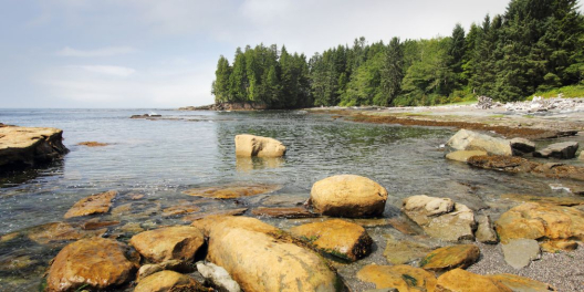
The hardest hit areas will be semi-enclosed bays and inlets, because all that raging water would be crammed into a narrow corridor.
Tsunami waves would reach up to six metres near Kyuquot, and up to 4.5 metres in communities along the inlets.
The study is not just computer models. It draws on knowledge of Indigenous Elders who tell of past tsunamis that hit the Island, including those in 1700 and 1964.
Study co-author Soroush Kouhi told the Vancouver Sun the study will be invaluable in creating the best community safety plans for different areas across the Island.
“Knowing where coastal vulnerabilities lie and the predicted areas at risk strengthens hazard awareness, allowing decision-makers and communities to mitigate, prepare, respond and recover from emergencies.”